• Skip to primary navigation
  • Skip to main content
  • Skip to primary sidebar
  • Skip to footer

News and entertainment worth sharing – York and North Yorkshire

  • News
  • Radio
  • Vouchers
  • WIN
  • More
    • Tickets
    • Lifestyle
    • Advertise
    • About
    • Contact

Flooding and storms in York and North Yorkshire – As it happened

York live

Monday, 21 February 2022

Updates as floodwaters rise in York and North Yorkshire, and bad weather brings high winds and rain. Got info? Let us know on Twitter, or at [email protected]

All the latest flood warnings are here


• Key updates

  • Floods in York and North Yorkshire: The situation tonight

    3 years ago

  • New flood warnings in the Selby district

    3 years ago

  • The Boston Spa bridge has reopened after checks

    3 years ago

  • Tadcaster Albion hit by floods AGAIN

    3 years ago

  • North Yorkshire latest: Roads closed by flooding

    3 years ago

  • New forecast issued for the peak river level in York – and it is down again

    3 years ago

Refresh for latest updates

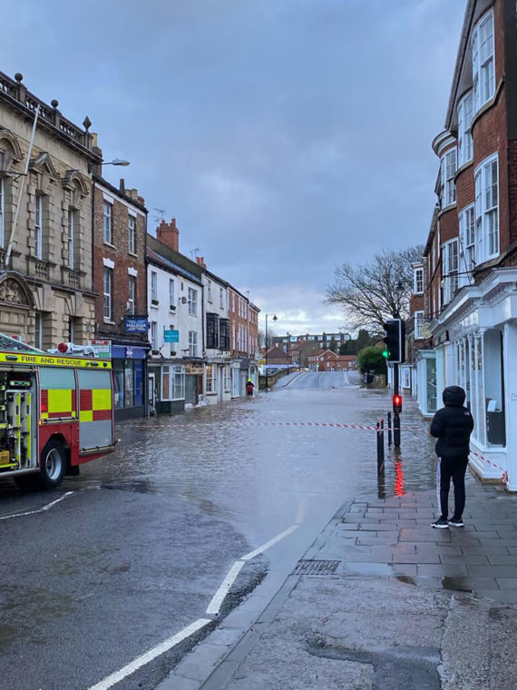
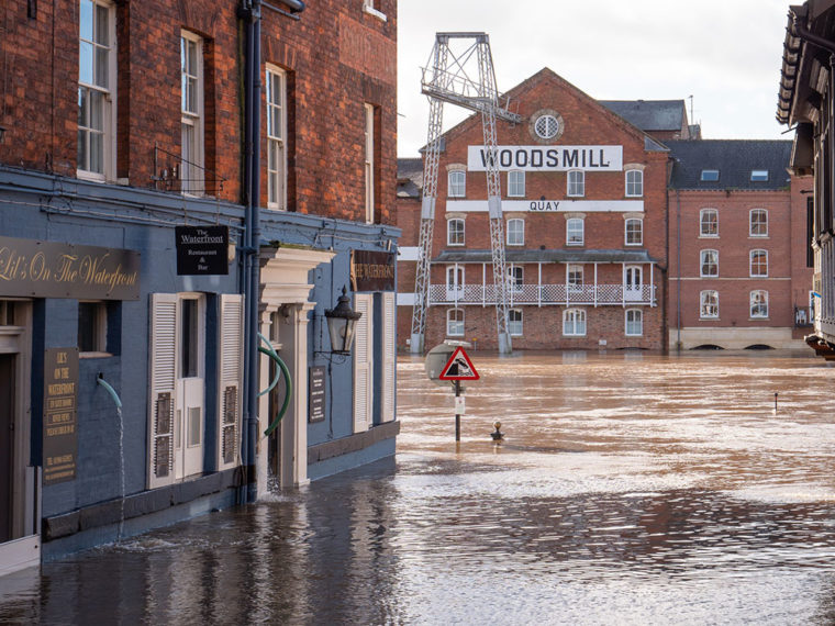
Floods in York and North Yorkshire: The situation tonight

3 years ago

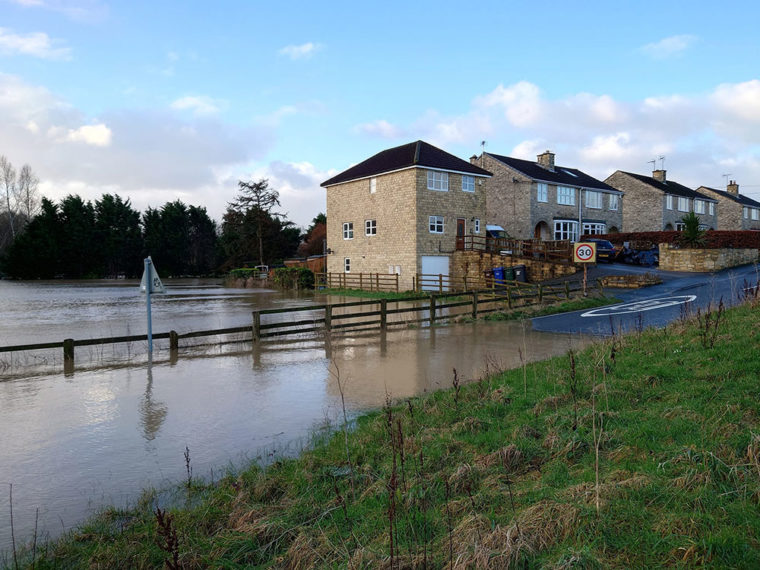
Photograph: Sandy Macdonald on Twitter

The River Wharfe at Tadcaster has peaked tonight – and the River Ouse will peak tomorrow morning below 5m.

And there are now 11 flood warnings in place in and around York.

Those are the headlines as we close our live flooding blog tonight.

This is what a spokesperson for the Environment Agency told us:

We know the devastating impact that flooding can have, which is why protecting people and communities is our top priority. 

Water levels in the upper catchments are going down and the picture is improving in these areas. The river level in Tadcaster has now peaked.

Although predictions can change as the forecasting model updates, we expect the Ouse to be at its highest level mid-morning on Tuesday. We have now issued all planned flood warnings and don’t anticipate that we will need to issue any further warnings at this stage.

People should remain vigilant and take extreme care. We encourage people to check their flood risk online and keep up to date, follow @EnvAgency on Twitter for the latest updates or call Floodline on 0345 988 1188.

By 8pm tonight, the Ouse in York was at 4.38m. It is now predicted to peak at 4.80m at 9.45am tomorrow (Tuesday).

These are the 11 flood warnings:

  • River Ouse at Acaster Malbis
  • River Ouse at Acaster Selby
  • River Ouse at Bishopthorpe
  • River Ouse at Linton Lock
  • River Ouse at Naburn Lock
  • River Ouse at York – Fulford and Fordlands Road
  • River Ouse at York – Peckitt Street
  • River Ouse at York – riverside properties
  • River Ouse at York – Skeldergate and Tower Street
  • River Ouse at York – St George’s Field and Queen’s Staith
  • River Wharfe at Kirkby Wharfe

Thanks for following along, tweeting and messaging us. Stay warm and dry tonight.
New flood warnings in the Selby district

3 years ago


This from Selby District Council:

A flood warning has been issued for the River Aire at West Haddlesey, Chapel Haddlesey and East Haddlesey. More information: https://t.co/c3raGkXiV6

— Selby DC (@SelbyDC) February 21, 2022

The Boston Spa bridge has reopened after checks

3 years ago


Good news – the bridge that spans the River Wharfe between Boston Spa and Thorp Arch has reopened.

We reported that it had shut over safety concerns earlier today.

In a post shared by the Tadcaster Citizen on Facebook, Sarah says:

I am not sure if you’re aware that the bridge at Thorp Arch has reopened.

The structural engineers have assessed the bridge & state it’s blocked drains pushing up the tarmac & not a crack that seems to be circulating on Facebook.

My dad works in the area & has been back & forth dealing with the floods in the area at Thorp Arch Mill. I am just letting you know so people don’t panic about getting home.

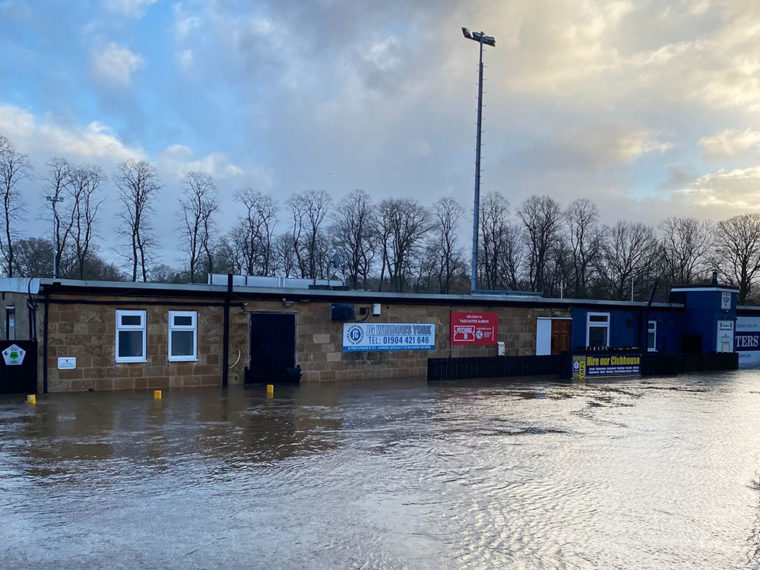
Tadcaster Albion hit by floods AGAIN

3 years ago

Waterlogged pitch… Photograph: Tadcaster Albion on Twitter

This is very sad to see.

Tadcaster Albion has been hit again by floods.

The ground is underwater today, with the club tweeting: “Not a good morning. We will await the water to go down and see the damage.”

The last flood at the ground was just over a year ago, in January 2021.

Not a good morning @TadcasterAlbion
We will await the water to go down and see the damage!! pic.twitter.com/np2y2uherY

— Tadcaster Albion (@TadcasterAlbion) February 21, 2022

North Yorkshire latest: Roads closed by flooding

3 years ago


Here’s the latest from North Yorkshire County Council on roads which are closed by floodwater, and those that are passable with care.

Things may have changed since this tweet however, so do use your judgment. Emergency services emphasise you should never drive into floodwater.

(2/4) – A168 near Thornton le Street
– B1223 The Fleet, Ryther

Closed:
– Road into Kirby Wiske
– Sandhill Lane (road to Holme on Swale from B6267
– Eldmire Lane
– Dalton Lane
– Occany Lane, Farnham
– East Farm to Grey Gables, Laverton/Ripon
– Catttal Moor Lane, Cattal pic.twitter.com/SpwSjRAMfm

— North Yorkshire Council (@northyorksc) February 21, 2022

(4/4) Closed:
– Morton on Swale Bridge
– Little Langton
– B1257 Golder Square to Stockings Lane
– Intake Lane, Beal
– Raw Lane/New Lane, Ulleskelf
– New Road Ulleskelf
– B6160 between Linton Crossroads and Threshfield highways depo pic.twitter.com/RA8Pc7bWOD

— North Yorkshire Council (@northyorksc) February 21, 2022

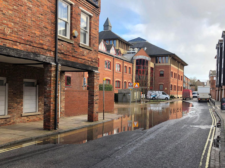
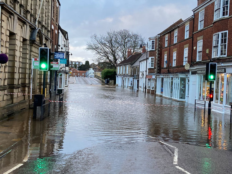
New pic: Skeldergate in York

3 years ago

Skeldergate in York at 3.15pm on Monday. Photograph: David Dunning

YorkMix‘s David Dunning has been out and about in York city centre and took this picture of Skeldergate at 3.15pm.

The water is still rising so it is expected to encroach higher up the road. But as you can see, it is far from the biggest flood of the street we’ve seen in recent years.

New forecast issued for the peak river level in York – and it is down again

3 years ago

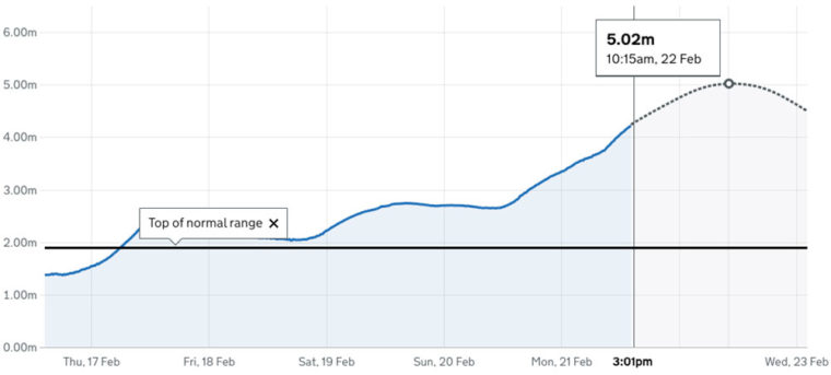
The latest river level forecast

Good news – another, lower, forecast for the peak of the River Ouse has been issued.

According to the update from the Viking Recorder in York city centre, the river had reached 4.28m at 3pm today (Monday).

And the new predicted peak level is estimated at 5.02m at 10.30am tomorrow.

That’s down from the previous forecast earlier today of 5.22m.

Video: Floodwater engulfs road west of York

3 years ago

 
Video: Anthony Starks

Floodwater has engulfed a road north west of York today (Monday).

This video was shot by Anthony Starks on Pool Lane, near Nun Monkton.

The floods swirl from the surrounding fields across the carriageway. A queue of cars is stopped close to where the water begins.

There are several flood warnings and alerts on the rivers Nidd and Ouse in that area.

The River Nidd at Skip Bridge, close to where this footage was shot, reached 5.19m at 2.32pm – significantly higher than the 4.55m which is the top of the normal range.

Advice from police and the fire service is never drive into floodwater.

York Rescue Boat volunteer confirms Skeldergate is blocked by water

3 years ago


A trained volunteer from York Rescue Boat is now out and about checking river levels – and has confirmed that Skeldergate is now blocked by floodwater:

One of our volunteers is in York checking on the river levels and assessing our access points if we need to respond to incidents.
Access along Skeldergate is now blocked by flood water, the river levels will continue to rise through today. Please find an alternative route. pic.twitter.com/EXEc9d3b5l

— York Rescue Boat (@yorkrescueboat) February 21, 2022

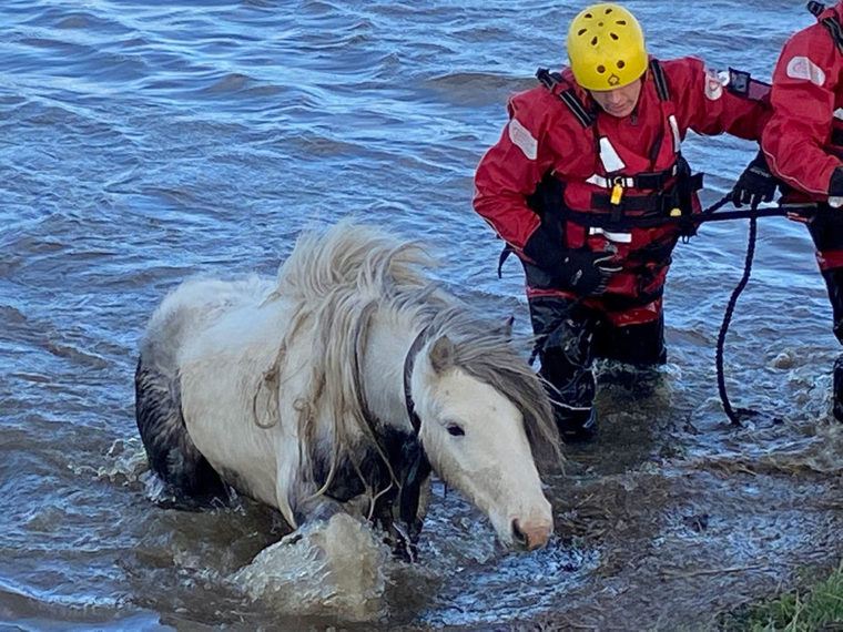
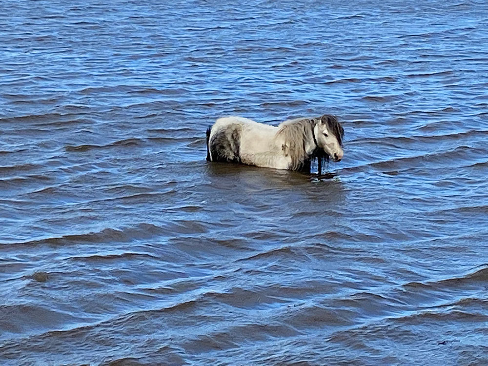
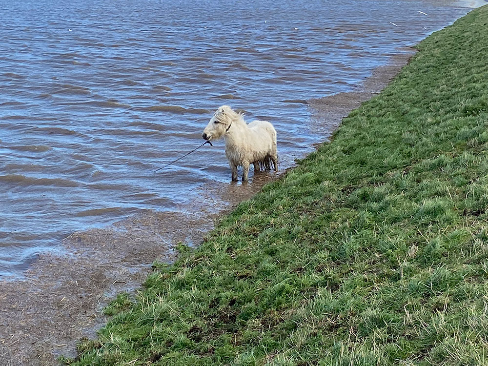
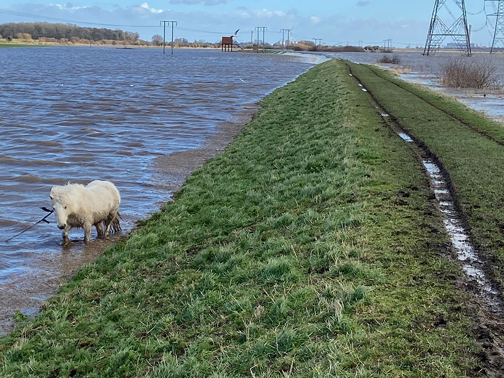
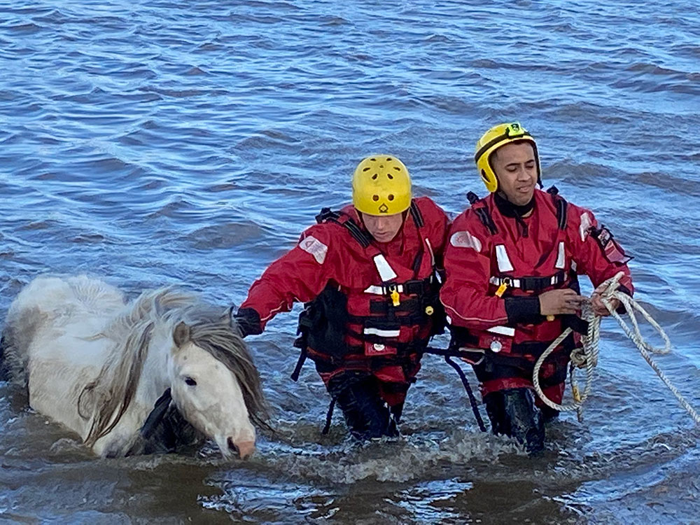
North Yorkshire firefighters rescue horses trapped in floodwater

3 years ago

A horse rescued from floodwater at Byram. Photograph: Group Manager Bob Hoskins on Twitter

They’ve already rescued people and pets from Knaresborough and residents in Tadcaster hit by flooding.

Now firefighters have saved three horses at risk of drowning as floodwaters rise in Byram.

Tadcaster fire station deployed its animal rescue team to help save the animals.

Group Manager Bob Hoskins said on Twitter: “The crews are using water rescue equipment reach the horses to release them from their harnesses.”

He added later: “Crews from Tadcaster have rescued 3 horses from rising water. The horses have been taken to their stables by the owner supported by North Yorkshire Fire & Rescue Service and North Yorkshire Police.”

Photograph: Group Manager Bob Hoskins on Twitter
Brought to safety. Photograph: Group Manager Bob Hoskins on Twitter

Buses diverted from Skeldergate

3 years ago


Earlier we reported that Skeldergate was still dry. But it looks like that has now changed.

East Yorkshire buses are now diverting away from the road:

York; Due to flooding on Skeldergate, services are diverting via Rougier Street and Nunnery Lane.

— East Yorkshire (@EYBuses) February 21, 2022

700 sandbags distributed across Selby and Tadcaster

3 years ago


This from Selby District Council – they have delivered 700 sandbags across the district, most to the Tadcaster area. And they say “Flood defences in the Tadcaster area are holding.”

https://twitter.com/SelbyDC/status/1495717557130739714

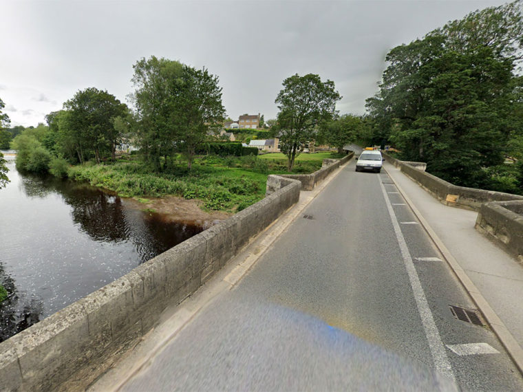
Reports of a crack in a bridge over the River Wharfe

3 years ago

The bridge said to be affected. Photograph © Google Street View

The Tadcaster Citizen community Facebook page is reporting a worrying development.

It states:

We are just hearing news about a crack in the road bridge which goes over the Wharfe from Boston Spa to Thorp Arch.

“We are told that the road over the bridge is closed to traffic & pedestrians & traffic is being diverted via Wattlesyke roundabout and Moor End.”

More on this when we get it.

Avoid Mill Lane in Tadcaster

3 years ago

Photograph: Stutton Village on Facebook

These pictures from the Stutton Village Facebook page show more of the flooding in and around Tadcaster.

Their message – avoid Mill Lane, as well as central Tadcaster. “Please advise friends/ family/ contractors that they will not make it through.”

https://www.facebook.com/StuttonVillage/posts/3084478981826017

Tadcaster garage closed – Posts pictures of flooded forecourt

3 years ago

One of the photos from Power Plus Autos on Facebook

This shows the devastating impact a flood can have on a local independent business.

The post is from Power Plus Autos on Commercial Street in Tadcaster.

It is one of the businesses that has been inundated after the River Wharfe burst its banks.

They are now closed for the week.

https://www.facebook.com/powerplusautos646/posts/1824788101057783?cft[0]=AZVZJ1grRPIzj5FcbmTWvYzk_IeZlO3HEip65KyO30BocXtaubnIcv2fMonklrmXYgxuLEbWkWujlMsSIiRF_dHUvWjn5ZlYM9hxOneWzr8LNqEkx5VqWPpzo3Fg0sxsT4yBPqWTV2G6nRv7sBU9yalu&tn=%2CO%2CP-R

New forecast issued for the peak river level in York

3 years ago

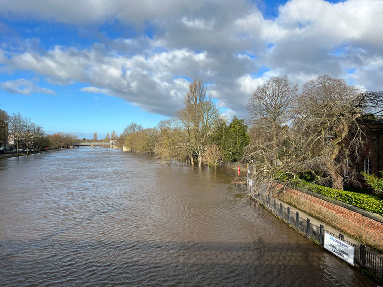
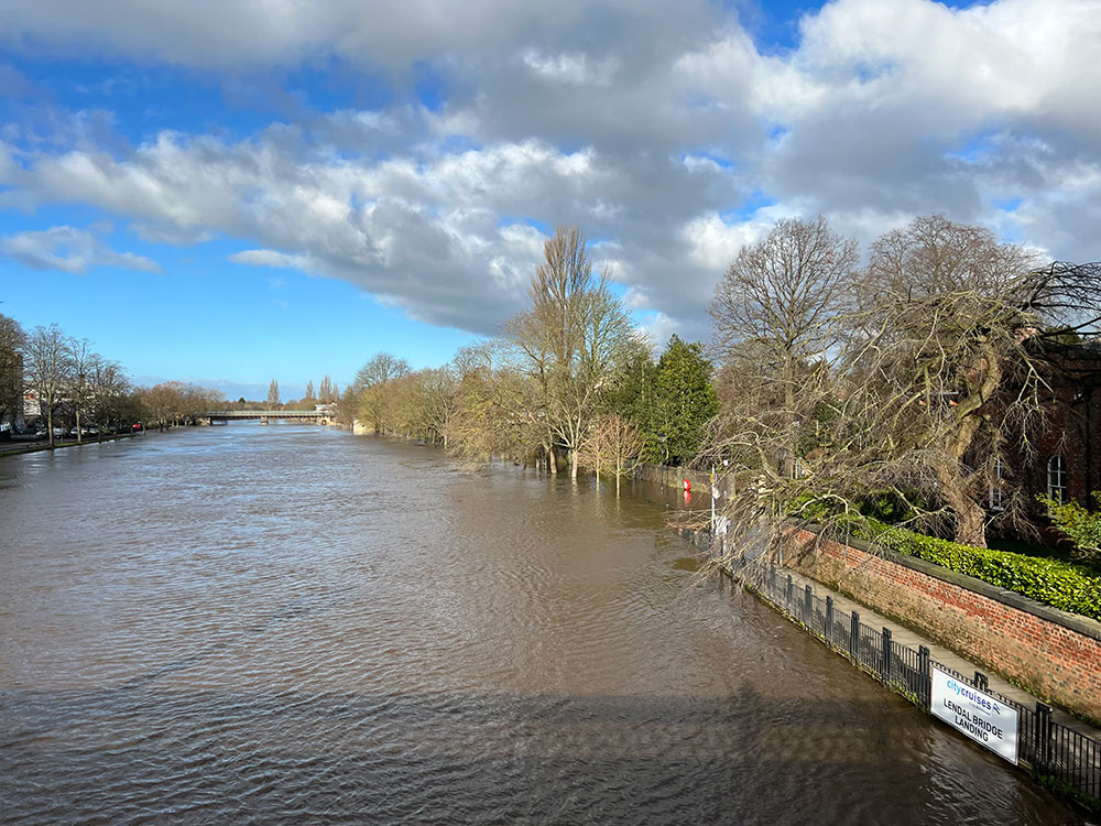
The view near Lendal Landing

A new forecast has been issued for the rising waters in York.

The peak level of the River Ouse has been revised downwards.

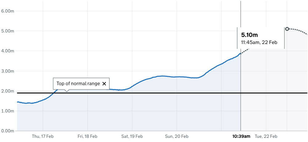
The modelling now suggests that it will rise to 5.1m at 11.45am tomorrow (Tuesday).

That is down from the previous forecast of 5.22m.

At 10.30am the river had reached 3.85m.

The latest forecast, as at 10.39am on Monday

Cars stranded in flooded York car park

3 years ago

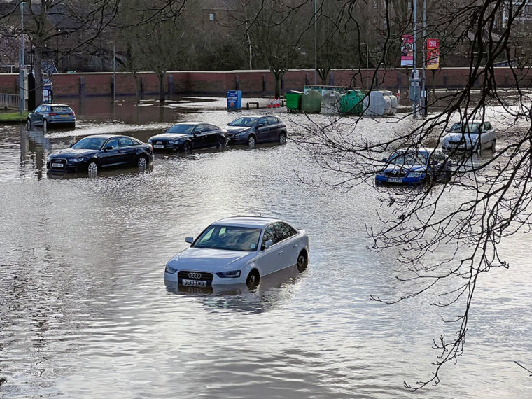
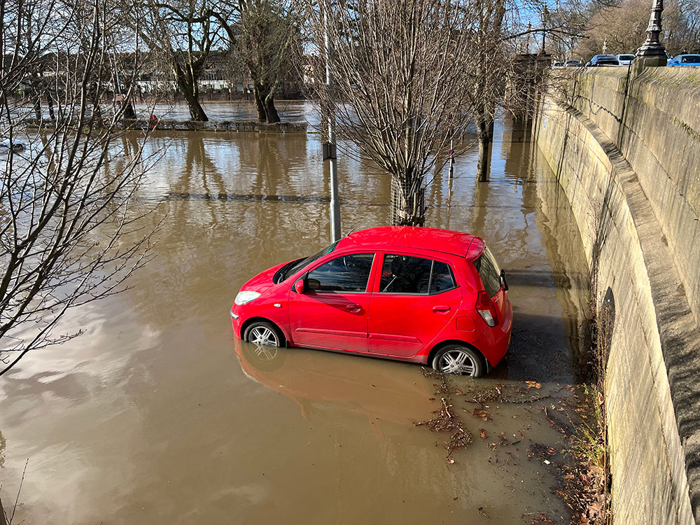
Cars stranded in St George's Field car park in the February 2022 flood. Photographs: Richard McDougall

It’s bad luck for these drivers who have left their cars in St George’s Field car park.

As is the norm, the car park is flooded after the Ouse burst its banks – and waters are still rising.

Needless to say, the car park is closed.

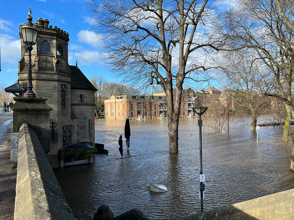
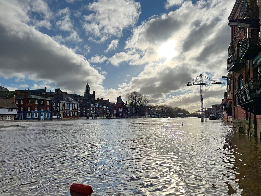
These latest pictures from YorkMix photographer Richard McDougall also show the river as seen from Skeldergate Bridge.

Another car in St George’s
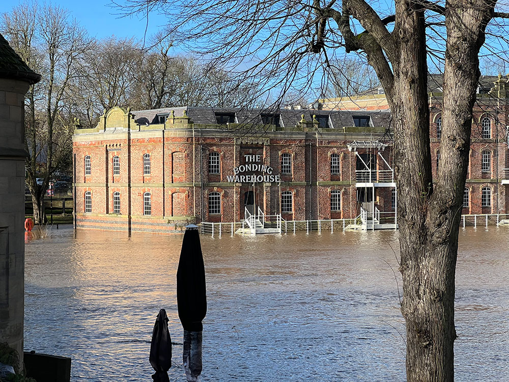
  • The view from Skeldergate Bridge
  • The levels at the Bonding Warehouse
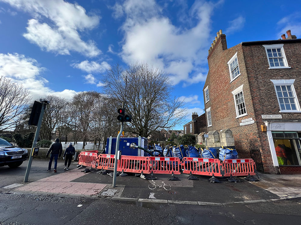
  • Sandbags in place at Tower Gardens

More pix from York – Skeldergate remains dry

3 years ago

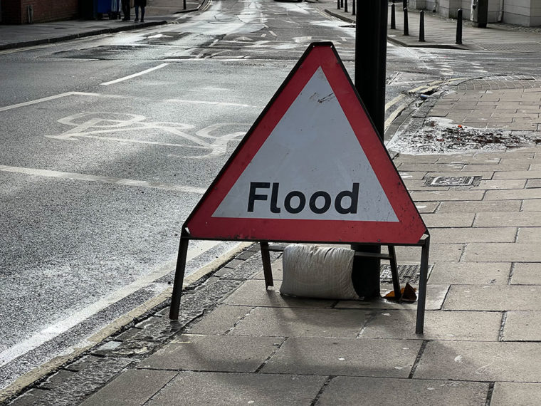
A flood sign on Skeldergate, which is still dry. Photographs: Richard McDougall

Our photographer Richard McDougall is out and about in York this morning taking a look at the state of the River Ouse.

According to the latest reading from the Viking Recorder, the Ouse stood at 3.75m at 10am. The forecast is still for it to peak at 5.22m at midday tomorrow (Tuesday).

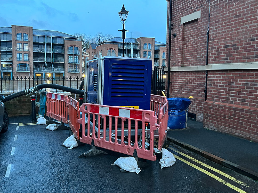
Skeldergate remains dry. There are sandbags and pumps at Tower Gardens.

In general, though, York is open as normal.

  • The Ouse on Monday morning
  • The view near Lendal Landing
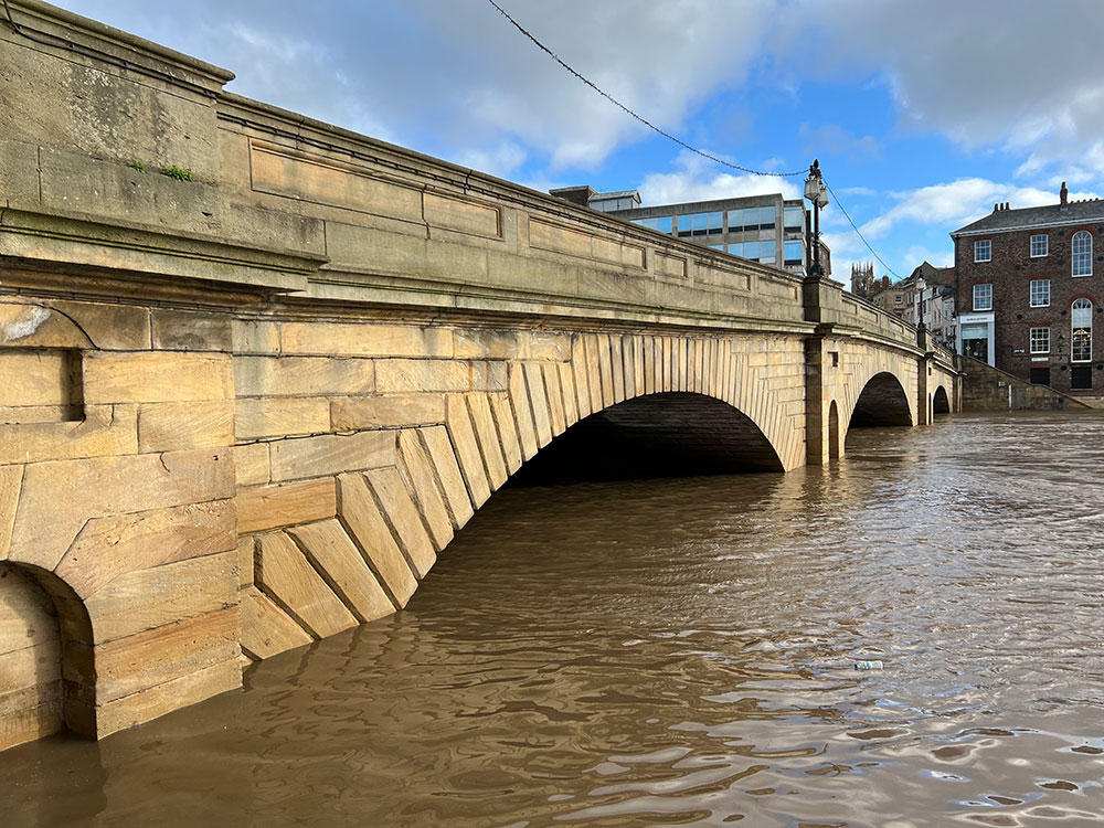
  • High levels under Ouse Bridge

Tadcaster homes evacuated after River Wharfe bursts its banks

3 years ago

Flooding on Bridge Street and Commercial Street in Tadcaster. Photograph: Group Manager Bob Hoskins on Twitter

These pictures come from Bob Hoskins of North Yorkshire Fire & Rescue Service.

In the early hours of this morning the River Wharfe burst its banks. Water has entered properties on Bridge Street and Commercial Street.

Tadcaster firefighters and the police are helping residents to move furniture and evacuate.

Photograph: Group Manager Bob Hoskins on Twitter

York Rescue Boat on standby

3 years ago

The volunteers and waterway experts at York Rescue Boat are on standby as the river levels rise.

They are ready to respond if required as part of the Local Resilience Forum

This is the YRB’s latest take on the situation.

Some businesses have had to close but the vast majority of York is still open for business.
If you do come to York please stay safe. Do not drive, cycle or walk through flood water, you cannot always tell if there has been any substance or any manhole covers are missing. pic.twitter.com/N1enyra1lD

— York Rescue Boat (@yorkrescueboat) February 21, 2022

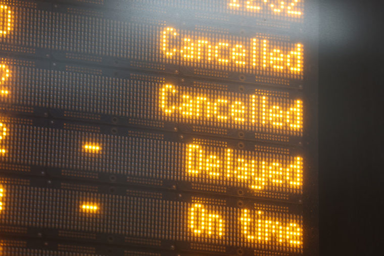
Storm Franklin hits rail journeys

3 years ago

Photograph: James Manning / PA wire

Many train operators are urging passengers not to travel as lines are blocked by fallen trees and flooding caused by Storm Franklin.

Northern said many of its routes are closed across the North West and Yorkshire.

It added: “Our advice is not to attempt to travel as we are unable to provide alternative transport.”

Other operators urging passengers not to travel include CrossCountry and TransPennine Express.

Here’s the latest from National Rail Enquiries.

Pictured: The flood that has closed Tadcaster bridge

3 years ago

Tadcaster bridge underwater. Photograph: Kirsty Perkins

As we reported earlier, Tadcaster bridge is closed due to floodwater.

Thanks to Kirsty Perkins for sending this image of the scene this morning.

Bridge Street is closed both ways between Kirkgate and Mill Lane.

The Environment Agency says the Wharfe is due to peak in Tadcaster around 4.30am tomorrow (Tuesday).


Tadcaster Bridge closed after river breaks through again


Five flood warnings and six flood alerts around York

3 years ago

As at 8.26am, there are five flood warnings and six flood alerts in and around York.

A warning is more severe – it means flooding is expected. An alert means flooding is possible.

Check the updates here.

Flood warnings
River Ouse at York – riverside properties
 Areas most at risk include Properties on King’s Staith in York and riverside areas through York from Lendal Bridge to Millennium Bridge. Property flooding is expected

River Ouse at York – St George’s Field and Queen’s Staith
The flood warning for the River Ouse at York – St George’s Field and Queen’s Staith remains in force as river levels are rising due to recent heavy rainfall in the Dales. Flooding of properties, gardens, roads and paths is expected.

River Ouse at Naburn Lock
Flooding is expected to affect locations near the River Ouse, with low lying land expected to be most affected, particularly around Naburn Lock Buildings and Lock Cottages.

River Ouse at Linton Lock
Flooding is forecast to affect locations near the River Ure, with low lying land expected to be most affected, particularly around the caravan park at Lock Bridge and isolated properties at Linton Lock. 

River Wharfe at Kirkby Wharfe
The level of the River Wharfe at Tadcaster has now reached 3.7m and is expected to peak at 3.9m, before falling later on Monday morning.

Flood alerts
Upper River Ouse

The flood alert for the upper Ouse remains in force as river levels are rising due to recent heavy rainfall in the Dales. Flooding is expected to affect locations near the River Ouse, with low lying land most affected, particularly around Riverside footpaths and low-lying land in York and south as far as Naburn Lock, including Kings Staith, Queens Staith, and South Esplanade.

Tidal River Ouse from Naburn Lock to Selby
The flood alert for the Tidal River Ouse from Naburn Lock to Selby remains in force as river levels are rising due to recent heavy rainfall in the Dales. Low lying land around the River Ouse is at risk of flooding. You should avoid walking, cycling or driving through flood water.

Lower River Derwent
Flooding is forecast to affect locations near the River Derwent, with low lying land expected to be most affected, particularly around local roads and low-lying land around Stamford Bridge, Pocklington, Wressle, Wilberfoss and Elvington.

Lower River Nidd catchment
Flooding is forecast to affect locations near the River Nidd, with low lying land expected to be most affected, particularly around Land around the Lower River Nidd and its tributaries including Sand Beck, Sike Beck, Pool Beck and Great Gutter.

Lower River Wharfe
Flooding is forecast to affect locations near the River Wharfe, with low lying land expected to be most affected, particularly around The Lower River Wharfe and tributaries from Ilkley to upstream of Ulleskelf.

Tidal River Wharfe
Flooding of low-lying land and roads is possible. Levels are in Tadcaster rose overnight, and levels started to rise slowly around Cawood. 

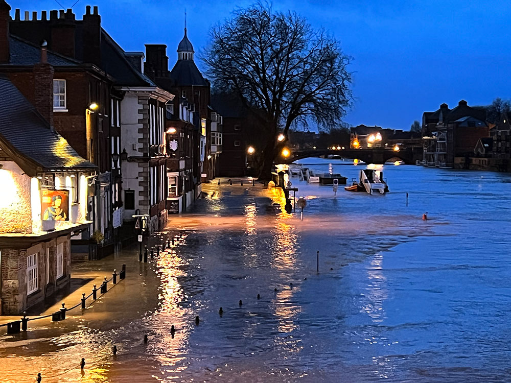
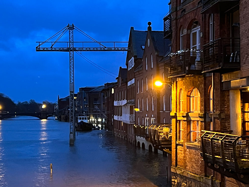
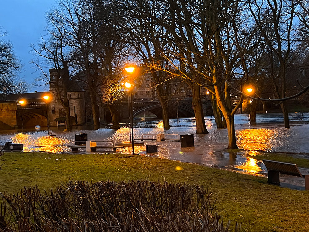
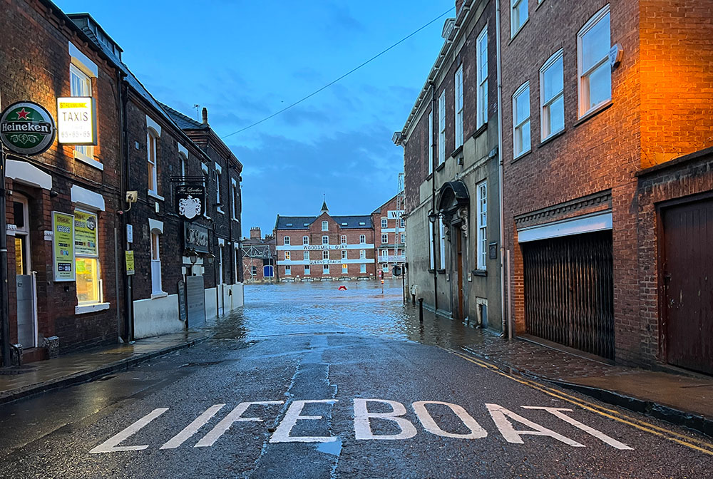
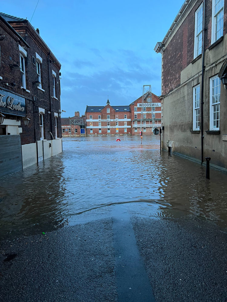
Flooding pictures from York first thing this morning

3 years ago

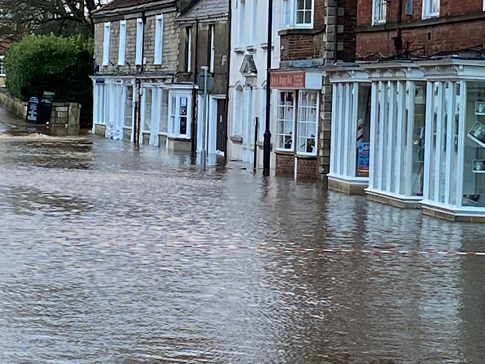
We were out and about first thing this morning (Monday) checking out the river levels in York.

Here are some of the pix.

Footer

Contact us

General
01904 375 029

Studio/competitions
01904 375 030

Email YorkMix »

5-6 King's Court
Shambles
York  YO1 7LD

Listen to us

You can listen to YorkMix Radio using your DAB+ radio, Alexa or Google smart speaker, or online using the links below.

Click here to listen to YorkMix Radio »

Download the app from Google Play store
Download the app from Apple App store
About us

YorkMix is a trading name of
York Sound Ltd

Registered in England
Company no: 12831940
VAT no: GB289462452

YorkMix Radio public file

  • About
  • Public file
  • Privacy policy
  • Corrections & complaints
  • Contact

Copyright © 2025 YorkMix