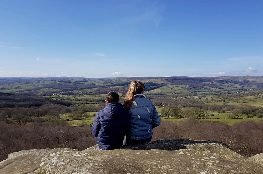
Walk off that Sunday roast… or maybe earn curry calories before your Saturday night take-away with our updated walks guide.
From less than one mile to more than ten, there is something to fit everyone here. Choose from the links below to jump to the type of walk you want, or scroll down to browse them all.
If you’ve got a favourite we’ve missed let us know by leaving a comment below or dropping us a line at [email protected].
Otherwise, get your boots on and get out!
In and near the city
St. Nick’s Nature Reserve

Less of a walk and more of a meander, this hidden gem is less than one mile from the city centre. There is no set route, but the map in the link below shows you the paths you can explore. Perfect for a family wander.
- 2 miles
- 1 hour
- Easy going
- Start: St. Nick’s Environment Centre
- Full details
Clifton walk
A circular walk from Bootham Bar that goes northwards away from the city, and returns by the riverside footpath to Lendal Bridge. It takes you to some of the Rowntree’s homes in Clifton which in their days lay right on the leafy outskirts of the city.
- 1.5 miles
- Less than 1 hour
- Easy going
- Start: Bootham Bar
- Full details
Out of town Rowntree walk
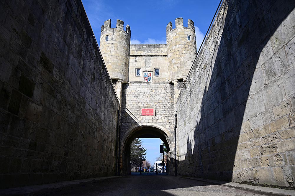
This walk takes you to some significant establishments and resting places connected with the Rowntree family. From the groundbreaking Retreat to the Quaker burial ground and back via Rowntree Park, it offers a new perspective on our historic city.
- 5 miles
- 2-3 hours
- Easy going
- Start: Walmgate bar
- Full details
Askham Richard, Bilbrough and Askham Bryan
This walk takes in a number of ancient settlements to the West of York, with Askham Richard, Bilbrough and Askham Bryan all recorded in the Doomsday book of 1086. Bilbrough is 150 feet above sea level and as a result, the village commands extensive views over the Vale of York.
- 6.5 miles
- 3 hours
- Moderate going
- Start: Askham Richard
- Full details
Skelton
This walk starts in a conservation area and takes in the Church of St Giles, which is Grade I listed and dates from c1240. Tasing through the edge of the city, it returns North along the bank of the River Ouse, affording long views across Poppleton Ings.
- 5 miles
- 2 hours
- Moderate going
- Start: Skelton Primary School
- Full details
Wheldrake
To the south of York, Wheldrake is thought to refer to the historical presence of wells or springs that occur on the site of village. The walk tracks to the east of the village, with rich woodlands and the possibility of sighting deer or a fox.
- 6 miles
- 3 hours
- Moderate going
- Start: Wheldrake village
- Full details
Solar system walk
This linear walk is really intended as a cycle ride, but can be a great walk with lots to talk about with children. Although the full route is 13 miles long (6.5 miles each way), you can turn back after any planet, making it as scalable as you like. Models of our sun and associated planets are spaced out as they would be if our solar system was reduced in size to fit this stretch of what was the old East Coast main-line railway. Bishopthorpe, just before Jupiter, has perfect pubs for lunch with child-friendly gardens.
- Up to 6.5 miles (one way)
- 3 hours
- Easy going
- Start: Sim Balk Lane, near York College
- Full details
York city walls
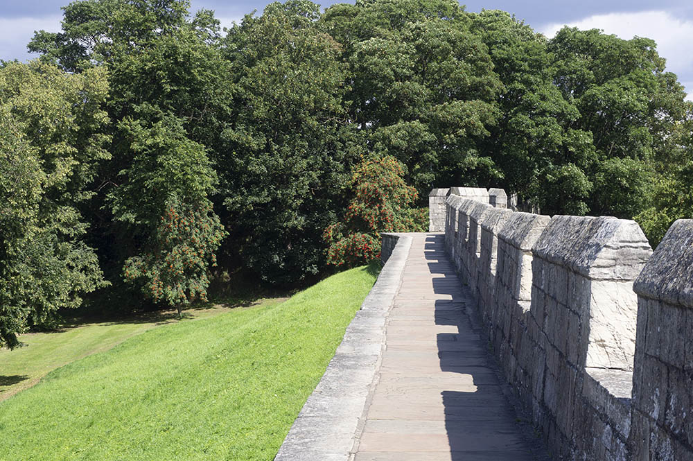
An oldie but a goodie. The length of the walls is less than three miles, and for that you get two millennia of history.
- 2.6 miles
- 1 hour
- Easy going
- Start: Bootham Bar
- Full details
Heslington
A simple walk on the edge of York which takes you out of an ancient village and back again, via Common Lane.
- 2.5 miles
- 1 hour
- Easy going
- Start: Low Lane, Heslington Main Street
- Full details
Fulford
The quickest of these walks, this is a jaunt around the Fulford Ings. Features boathouses and a variety of wildlife – but sometimes floods after heavy rain.
- 1.5 miles
- 40 mins
- Easy going
- Start: Fulford Main Street
- Full details
Stockton on the Forest
With names like Bean Land Lane and Nova Scotia Farm this walk has a charm of its own. And you can visit Brockfield Hall in the summer months.
- 3.75 miles
- 1.5 hours
- Moderate going
- Start: Stockton on the Forest Main Street
- Full details
Bishopthorpe
Here you get to explore Bishopthorpe itself (with plenty of places to eat and drink), skirt the river and walk along the edge of York Racecourse.
- 5.75 miles
- 2 hours
- Easy going
- Start: Bishopthorpe Library
- Full details
Holtby
Just a stretch of the legs, this route takes you from the Vale of York village across to Dunnington Hall and back.
- 2 miles
- 1 hour
- Easy going
- Start: Holy Trinity Church, Holtby
- Full details
Elvington
Stretch your legs in this walk around the fields and farm land surrounding Elvington – and see if you can spot some ducks and geese along the way. With this walk there is also an option to visit the river Derwent.
- 3.75 miles
- 1.5 hours
- Easy going
- Start: Beck Close, Elvington
- Full details
Bishopthorpe
Here you get to explore Bishopthorpe itself (with plenty of places to eat and drink), skirt the river and walk along the edge of York Racecourse.
- 5.75 miles
- 2 hours
- Easy going
- Start: Bishopthorpe Library
- Full details
Fulford and Heslington
This walk takes you past the Heslington Tillmire which is a large area of common land designated as a Site of Special Interest – owing to its important marshy grassland and fen plant flora. It also provides an important habitat for breeding birds such as lapwing, snipe, curlew,
teal and pintail – so perhaps a good one for keen birdwatchers!
- 4.75 miles
- 2 hours
- Easy going
- Start: End of Fordlands Road, Fulford
- Full details
New Earswick
Explore the ‘garden village’ of New Earswick in this customisable walk that goes over Yearsley Bridge and past the old Rowntree’s factory and along Wigginton Road.
- 2.25 miles or 6.25 miles
- 1 hour or 3 hours
- Moderate/challenging going
- Start: New Earswick Library
- Full details
Osbaldwick
A circular walk around the village of Osbaldwick that goes past ‘Bad Bargain Lane’ – it was named after a small holding in the nearby parish of Holtby and was regarded as a ‘bad bargain’ by a disgruntled owner, as the enclosure allotment contained two thirds of an acre of swampy pond…
- 2.5 miles
- 1 hour
- Easy going
- Start: St Thomas Church Osbaldwick
- Full details
Country walks
Aldwark Ramble
This pleasant stroll takes a circular route through cultivated, wildlife-rich countryside under wide open skies. It takes you where witches walked, through the ancient hunting grounds of kings and links in with a man who fought at the Battle of Hastings.
- 4 miles
- 2 hours
- Easy/moderate going
- Start: Aldwark Church
- Full details
Nunnington
A varied walk that starts in a pretty village with its ancient church, takes in the legend of the Nunnington dragon, a ridge walk with panoramic views and, depending on the time of year, the chance of plenty of wildlife. The National Trust property of Nunnington Hall is also well worth a visit.
- 1.5 mile
- Less than 1 hour
- Easy/moderate going
- Start: Nunnington Church
- Full details
Wainstones
Some of the most spectacular views in the whole National Park unfold as you cross the heights of Cold Moor, en route to the magnificent rock crags known as the Wainstones.
- 8 miles
- 5.5 hours
- Moderate going
- Start: Chop Gate Village Hall
- Full details
Brayton Barff
In the open valley of Pickering, this route flows through ancient woodland and is a great spot for bird watching and spring bluebells. Several other footpaths branch off to take you exploring through the woods or climbing towards the summit, which is the highest point for miles within an area dominated by flat agricultural land. Please note: these extra paths are less suitable for wheelchairs and pushchairs.
- 1.3 miles
- 45 minutes
- Easy going
- Start: Brayton Barff
- Full details
Kirkham Priory
A circular walk starting at the majestic ruins of Kirkham Priory next to the River Derwent. The route follows woodland and open paths through the pretty Howardian Hills before returning along the riverbank. The walk offers you and your pooch a bit of a climb to get the blood pumping, as well as the chance for a paddle and a good romp in the fields and along the path by the river. Views are plentiful amid the peace and quiet.
- 5 miles
- 2.5 hours
- Moderate going
- Start: Kirkham Priory car park
- Full details
Fountains Abbey

Learn a little more about the ancient trees in the Deer Park and gain insights into 18th-century landscaping. Follow the bridleways, footpaths and roadways through this delightful estate on this dog-friendly walk.
- 2.5 miles
- 1 hours
- Easy going
- Start: Fountains Abbey visitor centre
- Full details
Pickering Castle and Newbridge
Heading though quiet lanes and pastures to the railway crossing at Newbridge before climbing into woodland and returning via Pickering Castle. Dog-friendly, the paths through woodland and pastures can get muddy.
- 2.5 miles
- 1 hour
- Easy to moderate going
- Start: Pickering library
- Full details
Swinsty Reservoir, Harrogate
This route around Swinsty Reservoir nestles in the stunning Washburn Valley and provides breathtaking views across the water and the surrounding landscape, especially from the embankment near the River Washburn or various rest points dotted along the walk.
- 3 miles
- 1.5 hours
- Easy going
- Start: Swinsty Moor car park
- Full details
Haworth Moor
Straddling the Pennines, this invigorating walk sweeps through the wild moorland and heather which was an inspiration for the Bronte sisters Charlotte, Emily and Anne. The paths and tracks on this route provide views up to Top Withens ruins, connected locally to Emily’s famous novel Wuthering Heights and the surrounding moors. Visitors are asked to keep all dogs on a lead in the interest of farming and conservation.
- 5 miles
- 3-4 hours
- Challenging going
- Start: Penistone Hill Country Park car park
- Full details
Selby waterways trail
A 2.8 mile flat route with very little incline. Discover Selby lock basin, David Mayne’s sculpture, moored canal boats and Brayton bridge.
- 2.8 miles
- 1.5 hours
- Easy going
- Start: Selby Canal lock basin
- Full details
Stamford Bridge and the River Derwent
Explore the history of the village including the site of the Battle of Stamford Bridge and a long peaceful stretch alongside the idyllic River Derwent. Passing underneath the old viaduct, the walk has a one mile stretch along a quiet country lane, passing the old station before returning to Stamford Bridge.
- 10 miles (can be shortened)
- 4 hours
- Easy to moderate going
- Start: Viking Road car park
- Full details
Castle at Sheriff Hutton
The ruins of Sheriff Hutton’s Neville Castle dominate this walk throughout, sitting as it is on a slight rise and still containing some impressive high walls. Rising up at the edge of the Vale of York, impressive views across the plain abound.
- 8.5 miles (less with shortcut)
- 4.5 hours
- Moderate to challenging going
- Start: Sheriff Hutton
- Full details
Forge Valley Woods
Take to the boards on this easy-going 2-mile linear route along a a fairly level, wooden boardwalk. It meanders through the strikingly beautiful woods of Forge Valley. It’s a joy to walk at any time of year. In spring you’ll find yourself overwhelmed with great swathes of pungent wild garlic and delightful wood anemone; in autumn, the woodland colours are magnificent.
- 2 miles (one-way)
- 1 hour
- Easy going and accessible
- Start: Old Man’s Mouth car park
- Full details
Staindale Lake
It may only be a half-mile stroll, but the views along this walk are superb. Entrance to Dalby Forest is by toll road (admission charged), but it’s well worth it. Stop off at Low Dalby for refreshements, a paddle in the stream and to hear the zip-wire screams of GoApe high fliers.
- 0.5 miles
- 30 minutes
- Easy going and accessible
- Start: High Staindale car park
- Full details
Lord Stones Walk
It might only be a shade under 3 miles, but this is a real adventure walk for all the family, with some awe-inspiring views into the bargain. There’s a striking panorama of Middlesbrough, the Cleveland plain, Roseberry Topping and Cook’s Monument.
- 3 miles
- 2 hours
- Moderate going
- Start: Lord Stones Country Park
- Full details
Farndale
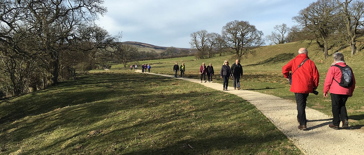
This is the famous ‘daffodil dale’. Between mid-March and mid-April the whole route is lit up by the yellow flowers, leading you to the Daffy Cafe, but it’s a lovely walk at any time of year. A great one for families too.
- 3.5 miles
- 2 hours
- Easy going
- Start: Low Mill car park
- Full details
Beningbrough
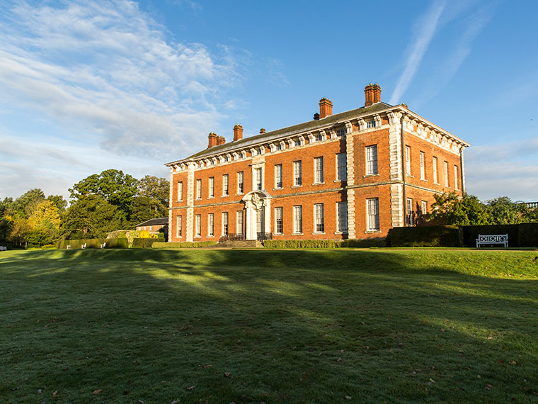
Only a 20 minute drive from York city centre this walk is suitable for all ages. Takes in the open parkland around Beningbrough Hall, York’s country house now owned by the National Trust.
- 4 miles
- 2 hours
- Easy going
- Start: Newton-on-Ouse
- Full details
Thornton le Dale and Ellerburn
One of the prettiest villages in the North York Moors National Park, Thornton le Dale is a beautiful spot to start and finish this walk. It takes you to the hamlet of Ellerburn and its ancient church, and features stretches along the wooded riverside
- 2 miles
- 1 hour
- Moderate going
- Start: Thornton le Dale car park
- Full details
White Horse and Kilburn Woods
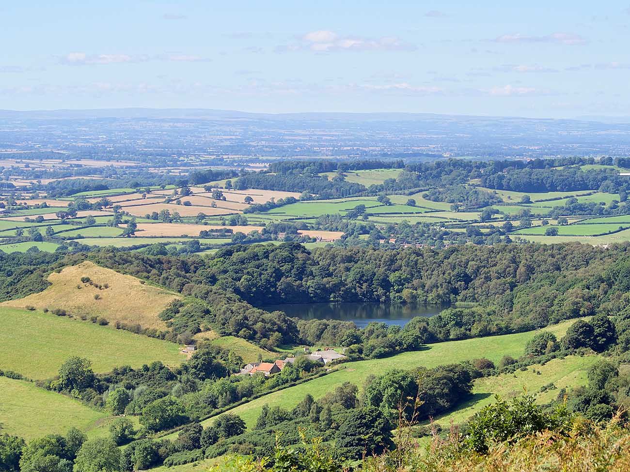
A circular and fairly strenuous walk taking in the steep valley slopes of Kilburn Woods and the Kilburn White Horse chalk figure set into the hillside.
- 6 miles (shortcuts can be made)
- 3 hours
- Moderate going
- Start: Sutton Bank North York Moors visitor centre
- Full details
Bishop Wilton
This more challenging walk offers a chance to climb hills, explore deep dales all the time while benefiting from great countryside views. Car parking available, and dog-friendly too.
- 7 miles
- 3.5 hours
- Moderate/hard going
- Start: Eastern end of the village
- Full details
Hutton le Hole and Lastingham
With its undulating grass banks where sheep roam free, Hutton le Hole is like something created for the James Herriot World of Adventures. Also on this charming walk check out Ryedale Folk Museum and Lastingham’s St Mary’s Church.
- 4 miles
- 2.5 hours
- Moderate going
- Start: Hutton-le-Hole
- Full details
Terrington
Hidden valleys and unexpected viewpoints await. The seclusion of Mowthorpe Dale and the peaceful limestone villages of Terrington and Ganthorpe provide contrast during your walk.
- 3.7 miles
- 1.5 hours
- Moderate going
- Start: Terrington Village Hall
- Full details
Ripley Castle
Rolling countryside dotted with isolated farms, with some glimpses of the castle estate on the way. Food, drink and history at the castle itself.
- 5 miles
- 2 hours
- Easy to moderate going
- Start: Ripley car park
- Full details
Brimham Rocks

Managed by the National Trust, Brimham Rocks is a fantastic, oversized natural playground for kids aged from 3-63. Look out for flashes of blue as kingfisher fly past, and brown trout in the waters as you walk along the river path. Featuring panoramic views across Nidderdale.
- 6.3 miles
- 3-4 hours
- Moderate going
- Start: Brimham rocks car park
- Full details
Roseberry Topping
It’s a fair climb up the charmingly odd Roseberry Topping hill, but you are rewarded with a great spot for a picnic and some wonderful views.
- 2 miles
- 1 hour
- Moderate going
- Start: Car park near Newton under Roseberry
- Full details
Welburn with views of Castle Howard

Lots to see on this walk near the famous Castle Howard, including the Temple of the Four Winds, dating from 1738, and Ray Wood, a woodland garden with plants from all over the world.
- 5.5 miles
- 3 hours
- Easy going
- Start: Eastern end of Welburn village
- Full details
Thixendale
A nice walk with a few steep inclines along the Wolds Way. Who wouldn’t be enchanted by views across Honey Dale?
- 4 miles
- 1.5 hours
- Moderate going
- Start: Thixendale village
- Full details
Helmsley to Rievaulx Abbey
This circular route provides a walk with diversity – town views, a flora-filled wood, quiet villages and ruins of Rievaulx Abbey.
- 7 miles
- 4 hours
- Moderate/difficult going
- Start: Helmsley Castle car park
- Full details
Levisham Moor and the Hole of Horcum
A classic route over the North York Moors, and lots of history too. Lockton, three miles away, offers the closest refreshments.
- 5 miles
- 3 hours
- Moderate going
- Start: Saltergate car park
- Full details
Londesborough Village walk
Explore the old estate village and enjoy the tranquility of a former deer park. This walk takes in part of the Wolds Way.
- 3 miles
- 1.5 hours
- Easy going
- Start: Towthorpe picnic area
- Full details
Sawley
This circular walk takes you to and from the picturesque village of Sawley, between Pateley Bridge and Ripon. Along the way you’ll pass through woodland and along country lanes with sweeping rural views.
- 3 or 5.5 miles
- 1.75-2.5 hours
- Easy/moderate going
- Start: Sawley Village Hall
- Full details
The Yorkes of Bewerley
This walk takes you around what were once the extensive gardens and grounds surrounding Bewerley Hall which, until it was demolished in the 1920s, was the home of the influential Yorke family. The designed landscape, developed in the 18th to 20th centuries, included parkland, pleasure gardens, woodlands, ponds, walled kitchen gardens – and a folly.
- 5 miles
- 3.5 hours
- Moderate going
- Start: Pateley Bridge South Car Park
- Full details
Pub walks
Pocklington Canal
A fun walk along the Pocklington canal for you and your dog. Start the walk at the Melbourne Arms pub. There is a small pub car park but also parking on the street round and about. There is a well marked path to walk down to the canal.
- 4 miles
- 2 hours
- Easy going
- Start: Melbourne Arms pub
- Full details
Towton Battlefield
This historical walk explores the site of the Battle of Towton which was fought on 29 March 1461 near the Yorkshire village of Towton. It was a significant battle during the English Wars of the Roses, fought between the houses of Lancaster and York for control of the English throne.
- 4 miles
- 2 hours
- Easy going
- Start: Towton village
- Full details
Byland Abbey via Mount Snever Observatory
This circular walk starts in front of Byland Abbey. Byland Abbey was started in 1177 by the Savigny monks, a reforming branch of the Benedictines. From the abbey, the walk heads into Wass and then follows a track through a wood for about one mile to reach Mount Snever Observatory (a now disused stone tower) before descending to Oldstead and heading back to the Abbey.
- 4.75 miles
- 2 hours
- Moderate going
- Start: Byland Abbey
- Full details
Rosedale

Rosedale was part of industrial Yorkshire, with its ironstone mines, kilns and even a moorland railway. This circuit takes you from pretty Rosedale Abbey village through rolling valley farmland and into Rosedale itself, bringing you back along the old railway track past the impressive ruins of the old roasting kilns.
- 7.5 miles
- 6 hours
- Moderate/challenging going
- Start: Rosedale Abbey
- Full details
Mallyan Spout and Beck Hole
Long before Heartbeat and TV fame, the tumbling waterfall of Mallyan Spout helped put Goathland on the map as a tourist village in the nineteenth century. The walk descends into the wooded valley bottom, where Beck Hole Inn provides suitable refreshments, before returning along part of the track bed of the original Whitby-to-Pickering railway line.
- 3 miles
- 1.5 hours
- Moderate going
- Start: Goathland
- Full details
Coxwold and Husthwaite
Starting in the chocolate-box pretty village of Coxwold, the route can be a little indistinct in parts, but it’s worth persevering with. The reward is wonderful views from Beacon Banks north to the White Horse and the western moors and south over the plains of York. The Fauconberg Arms also offers liquid reward on completion.
- 5.5 miles
- 3 hours
- Moderate going
- Start: Coxwold church
- Full details
Osmotherley and Mount Grace
This circular walk touches every aspect of the village’s rich religious past. The village itself has both medieval church and 18th-century Methodist chapel, while following field and woodland paths to the northwest leads to the impressive ruins of Mount Grace Priory – the best-preserved Carthusian remains in the country.
- 3.5 miles
- 3 hours
- Easy/moderate going
- Start: Osmotherley market cross
- Full details
Fearby, near Masham
A short walk around Nidderdale Area of Outstanding Natural Beauty, including The Black Swan free house which runs regular beer festivals.
- 3 or 8 miles
- 1.25 or 4 hours
- Easy/moderate going
- Start: Black Swan, Fearby
- Full details
Malham Landscape
It starts with the climb up the 400 steps to the top of Malham Cove, then across the limestone pavement towards Gordale Bridge. From there it is definitely worth the short linear detour to the impressive Gordale Scar gorge and waterfall. The return route through Janet’s Foss is a complete contrast through heavy deciduous woodland. And then your choice of pubs, the Buck Inn and the Lister Arms.
- 4.5 miles
- 3 hours
- Moderate/difficult going
- Start: Malham National Park Centre
- Full details
[adrotate group=”3″]
Coastal walks
Robin Hood’s Bay to Whitby

Enjoy great views over the Bay and Whitby, passing the old lighthouse and fog horn, along this coastal path. The up and downs are not too bad (except Maw Wyke Hole) and the path generally in good condition; the ruins of Whitby Abbey becoming increasingly dominant on the Whitby approach. Catch the X93/93 bus back after refreshments in one of Whitby’s many lovely pubs.
- 6 miles
- 3 hours
- Moderate going
- Start: Robin Hood’s Bay
- Full details
Bempton to Buckton
A great walk any time, but perfect for June and July, when the Puffins, with their multi-coloured beaks, nest low down in deep crevices. Don’t miss St Michael’s Church in Bempton. Built in the 12th Century, it features an attractive stained glass window depicting St Francis, Bempton Cliffs and seabirds.
- 4 miles
- 2 hours
- Moderate going
- Start: RSPB Bempton Cliffs Seabird Centre
- Full details
Staithes and Port Mulgrave
Starting at the atmospheric old fishing village of Staithes, this walk takes in harbour-side cottages, cobbled streets and winding alleys. For the first half, it follows the Cleveland Way National Trail giving wonderful coastal views. The return is more rural and via the small hamlet of Dalehouse.
- 4 miles
- 2.5 hours
- Moderate going
- Start: Staithes car park at the top of the hill. NB. Don’t drive down into the old village!
- Full details
Filey
Filey creates for a magnificent coastal walk away from the hustle and bustle of a city. The beach is so long that it could never be overcrowded with people.
- 5 miles
- 2 hours
- Easy going
- Start: West Avenue car park
- Full details
Ravenscar to Robin Hood’s Bay
Make a day’s walk of it. From the craggy heights of Ravenscar the route runs across Howdale Moor for some classic moorland scenery before dropping down to the old Scarborough-to-Whitby railway line and along to the famous smugglers’ haunt of Robin Hood’s Bay.
- 11 miles
- 6.5 hours
- Moderate going
- Start: Ravenscar National Trust Coastal Centre
- Full details
