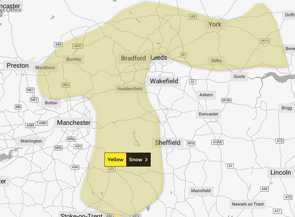
The Met Office has issued a yellow weather warning for snow that covers most of York.
The warning applies between 11am and 3pm today (Saturday, 19 February), and also covers the areas east, west and south of York, including Selby.
Forecasters say: “A short period of heavy snow may cause some temporary disruption on roads, mainly across higher ground such as the Peak District.
“Some roads and railways likely to be affected with longer journey times by road, bus and train services.”
Flood alerts in place
Meanwhile, several flood alerts are in place for York and North Yorkshire as river levels rise. The Foss Barrier may be activated today.
They are:
Upper River Ouse, York
The River Ouse in York is rising again in response to recent rainfall. The current river level in York is 2.6m. Flooding is expected to affect locations near the River Ouse, with low lying land most affected, particularly around Riverside footpaths and low-lying land in York and south as far as Naburn Lock, including Kings Staith, Queens Staith, and South Esplanade.
The current forecast indicates that the river Ouse at York will peak just below 2.9m late on Saturday morning. The Foss Barrier may be operated during Saturday. Levels are forecast to fall slowly during the day on Sunday.
Tidal River Ouse from Naburn Lock to Selby
River levels remain high due to recent rainfall and are expected to rise through this morning, Saturday (19 February). The current river level in York is 2.6m. The current river level at Naburn is 2.2m. Low lying land around the River Ouse is at risk of flooding.
Lower River Swale
Areas most at risk include The River Swale and tributaries from Catterick Bridge to the confluence with the River Ure.
River Foulness and Market Weighton catchment
This is likely to affect low lying land near the Market Weighton Canal, Mires Beck and River Foulness.
Upper River Aire catchment
Surface water issues and flooding of roads and farmland is possible. River levels are now falling but will begin to rise again around 1pm today (Saturday, 19 February) as a result of further persistent, heavy, rainfall.
You can see all the latest flood alerts here.
[tptn_list limit=3 daily=1 hour_range=1]