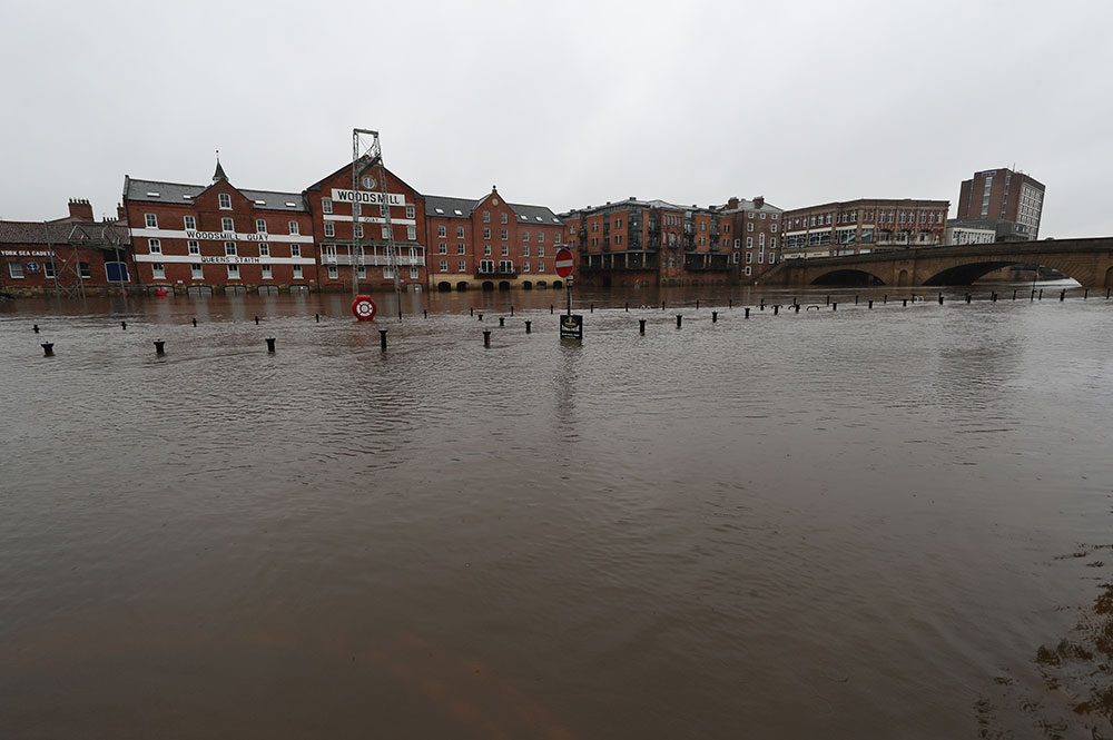
Here’s the latest on the floods in our area, as more rain hits the region from Storm Christoph.
As we reported yesterday, City of York Council has put up flood barriers and walkways in York in anticipation of the river levels rising.
And they have a Covid-safe evacuation plan for riverside residents, should the worst happen.
Flood updates are available from City of York Council here and from the Environment Agency here.
There are three flood warnings for York and 17 for the North Yorkshire.
Flood warnings
River Ouse, York city centre – 4.15am update: “Early forecasts indicate potential levels of over 4m later this week. Please prepare your property, avoid using low lying footpaths and do not walk, cycle or drive through flood water.”
This covers both riverside properties, and St George’s Field and Queen’s Staith. The Ouse is expected to rise to at least 4.24m tomorrow (Thursday), with property flooding possible above 3m.

River Ouse at Naburn Lock – 4.28am update: “Levels at Naburn will remain high. Please be aware that persistent and heavy rain is forecast until Thursday. We expect levels to rise significantly.”

Elsewhere in North Yorkshire
- Collingham Beck at Collingham
- Low lying properties in the Upper Hull catchment
- River Aire at Allerton Ings, Barnsdale Road and Properties
- River Calder at Horbury – The Strands
- River Derwent at Buttercrambe Mill
- River Derwent at Old Malton
- River Esk from Briggswath to Ruswarp
- River Nidd at Hunsingore
- River Nidd at Knaresborough Caravan Parks and Goldsborough Mill Farm
- River Nidd at Low Laithe
- River Roch at Littleborough
- River Roch in Rochdale
- River Seven at Marton
- River Seven at Normanby
- River Swale at Howe village and by Skipton Bridge
- River Ure at Roecliffe Caravan Park
- Walsden Water at Walsden
