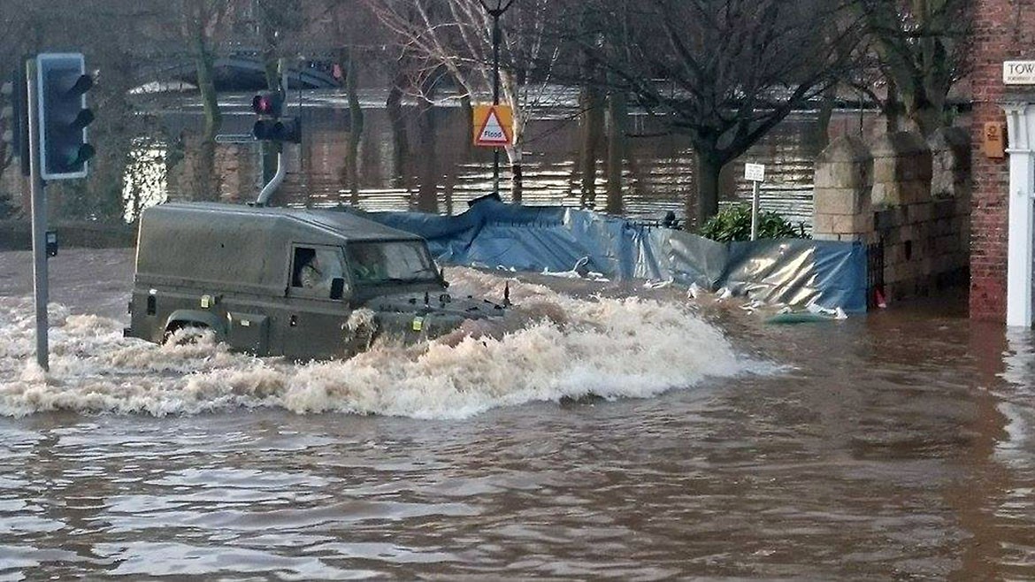
The Army are on York’s streets on Sunday (December 27) helping to sandbag city homes against some of the worst floods in years.
The Foss Barrier had to be lifted on Boxing Day after water entered the building leading to a danger of electrical failure. That means the Foss is being emptied into the Ouse putting thousands of properties at greater risk of flooding.
@BBCYork @yorkpress our Xmas ruined whilst @yorkfloodbarrier on Xmas hols … their pumps failed pic.twitter.com/EThWvujcHv
— Claire F (@kitkatapple) December 27, 2015
Six severe flood warnings from the Environment Agency remain in force. They are
Tang Hall Beck at York – Beckside Properties
Osbaldwick Beck at York – Osbaldwick and Tang Hall
Tang Hall Beck at York – Tang Hall
River Foss at Huntington Road and Foss Island
People are being evacuated from flood hit properties. A number of residents on Huntington Road were rescued by boat on Boxing Night (December 26) and taken to the rest centre set up at Archbishop Holgate School.


A City of York Council spokeswoman said people are working around the clock to tackle the floods:
Provisions are in place across multi-agencies following overwhelming river levels for the Foss and Ouse.
Representatives are working 24/7 from City of York Council, the Environment Agency, North Yorkshire Police, Yorkshire Ambulance Service, North Yorkshire Fire & Rescue, Northern Powergrid and Yorkshire Water.
The military are due to arrive in York at 6am. Armed Forces staff will be deployed to the council’s Hazel Court depot to support the flood protection work (sand bagging).
They will also be deployed to Cawood (Selby) and will be supporting the police on the evacuation of properties.


The River Ouse is currently 4.8 metres (15.74ft) above the average summer level and is expected to peak on Monday lunchtime at approx 5 asl.
People are advised to plan their journeys ahead by visiting the Environment Agency website and avoid flood water.
York road closures
Fishergate – both directions
A19 Fulford Rd
Piccadilly (near Ryedale Building)
Jewbury
Layerthorpe
James St
Tower St
Bad Bargin Lane
St Denys
Haxby Road
Lowther St
Skeldergate
Foss Island Road
Navigation Road
Shipton Rd (lower)
Hopgrove Lane/Carringdon Ave
Elvington Main St
Water End
Rufforth Main Street
Monks Cross Link Road
Huntington Road
Many public transport routes are affected and buses are being diverted. First York issued this list of diversions at 9.30am:
Disruption Update @09:30 pic.twitter.com/3bMYyOACuB
— First York (@FirstYork) December 27, 2015
More photographs of the flooding


The floods on Twitter
@BritishRedCross – loads of water at your York shop now #yorkfloods @yorkpress pic.twitter.com/QkYCE6tizn
— tim (@yorkie_pudding) December 27, 2015
@yorkpress Walmgate floods #yorkfloods pic.twitter.com/ooe96lvm8K
— tim (@yorkie_pudding) December 27, 2015
View from Piccadilly Plaza. #yorkfloods #flooding @yorkpress @BBCYork @KeeleyDonovan pic.twitter.com/PRDcYkEODK
— Rob McDameron (@Your_FunnyUncle) December 27, 2015

 York on flood alert: Roads closed, Foss Barrier raised, homes at risk and waters continue to rise – 35 pictures