A heat map of areas considered the most dangerous in York has been published.
It identifies the places where York residents felt unsafe, or were most unwelcoming, particularly at night.
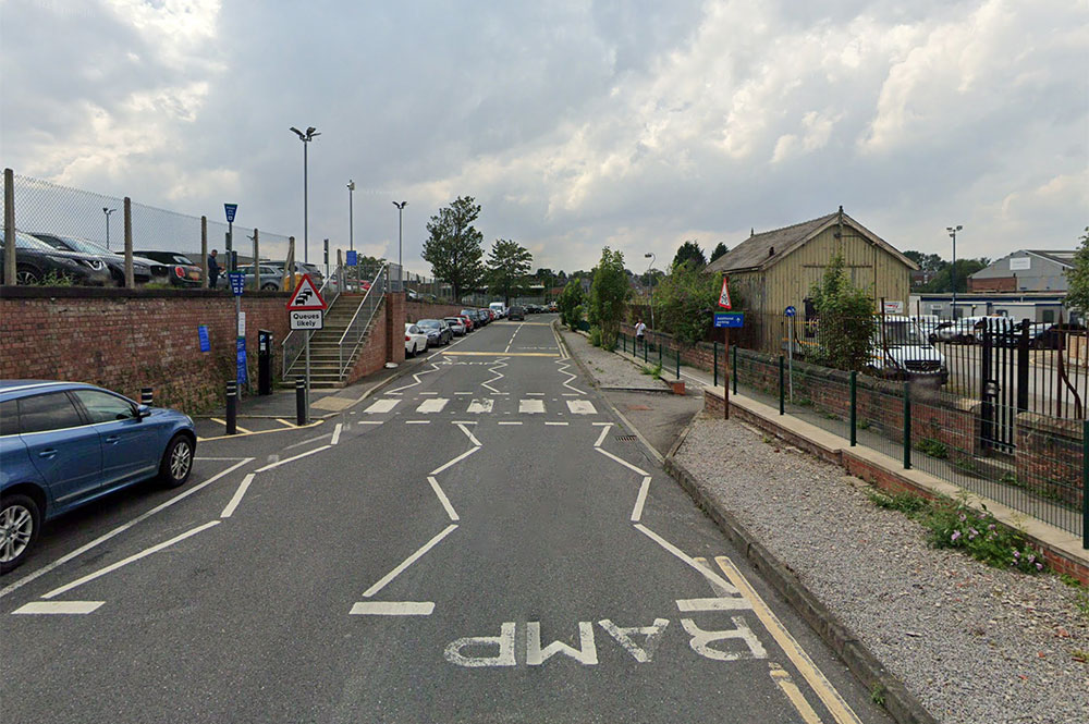
With Cinder Lane behind York Station topping the list, the map was drawn up by York Civic Trust after a Safer By Design workshop, which took place as part of York Design Week.
[tptn_list limit=3 daily=1 hour_range=1]
In the workshop, residents identified some of the city’s areas considered a safe or dangerous place.
According to the Civic Trust, York’s areas identified as the most dangerous are:
- Cinder Lane and railway bridge (behind the station)
- Along the river between Scarborough Bridge and Clifton Bridge
- Rougier Street
- Clarence Street
- Stonebow area
- Tang Hall Beck cycle path
- Hob Moor
- Love Lane and railway bridge
- Blue Bridge and New Walk.
“Recent tragedies in the UK remind us that the issue of our safety from harm in our towns and cities is continuing; sadly, York is not exempt,” the trust says.
“Despite modernity’s assurance that ‘these types of incidents are very rare’, this can feel hollow based on our lived experiences.”
Better design

The trust said their ‘unsafe areas’ heat map was not meant to identify no-go areas of York, but to start a discussion about how they can be improved.
“It was agreed that planning and urban changes is not a panacea for making the city universally safe, especially due to the need for wider changes in behavioural attitudes in some sectors of society, but it can make a positive contribution and so the opportunity to do should be seized.
“York was identified as a particular tricky city to protect people form harm due to its historic street pattern and needing to find a balance between design elements, such as street lighting and sight lines, and respecting the historic environment.”

“Interestingly, many of the identified areas identified as dangerous are on the periphery of the historic core of the city, and where a transition is found between it and the inner suburbs.”
Commenting on the map, one resident said: “As a resident in the Blue Bridge Lane area, while I am uncertain as to the dangers, the drunken pedestrian, alleged drug dealing and use of the Blue Bridge, New Walk and Blue Bridge Lane as a thoroughfare to and from the city centre and the trace course, make it at best a rowdy area.”
Read more here.