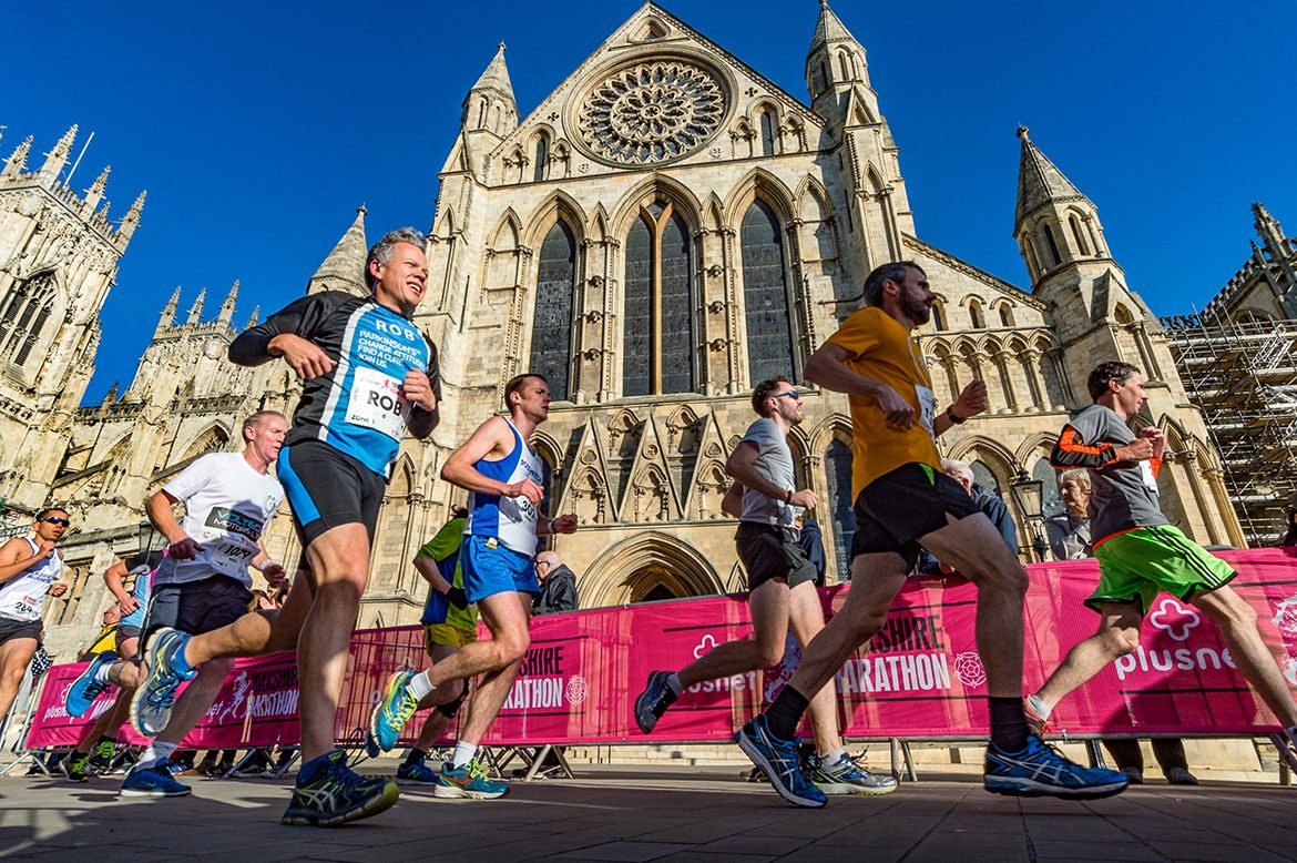
Thousands of runners will gather in York on Sunday (17 October) to take part in the eighth Yorkshire Marathon Festival.
A number of road closures and restrictions will be in place to ensure the safety of all those involved in the marathon, 10 mile and relay events.
The marathon starts and finishes at the University of York’s Heslington campus. It follows a route that takes runners through the historic city centre – passing through the medieval walls – and north eastwards out of the city.
[tptn_list limit=3 daily=1 hour_range=1]
Participants will travel through Stockton on the Forest, Grange Wood, Upper Helmsley, Stamford Bridge, Gate Helmsley, Turkers Wood, Murton, Osbaldwick and back towards Heslington.
To allow organisers to begin setting up the extensive event village, University Road, in York, will be closed between Innovation Way and Green Dykes Lane on Saturday October 16th from 10am. It will re-open at 11pm on Sunday October 17th.
On the Sunday, road closures at the A166, Church Balk, Church Street, Eastfield Lane and Stockhill Close will be in place from 6am.
City centre roads will also be affected by the closures and include Walmgate, Hope Street, Leadmill Lane, Piccadilly, Parliament Street, Blake Street, Duncombe Place, Deangate, Goodramgate and Monkgate with these in place from 8am.
Further afield, Heworth Green A1036, Stockton Lane, Common Lane, Northgate Lane, Holtby Lane, Murton Way, Bad Bargain Lane and Osbaldwick Lane will be among those affected from 8.30am onwards.
All road closures will be lifted as soon as the safety of runners, spectators and visitors can be assured.
Yorkshire Marathon Head of Events Tristan Batley-Kyle said: “The Yorkshire Marathon has grown into a major event on the running calendar, attracting runners from both home and abroad whilst raising funds for some excellent local charities.
“Unfortunately with an event of this size, a certain amount of disruption is unavoidable and we would like to apologise in advance for any inconvenience caused. We will work extremely hard to ensure that the road closures are lifted as soon as possible.”
Road closures
| Roads Closed | Closed From* | Closed Until* |
|---|---|---|
| University Road | 10:00 Saturday 16th October 2021 | 21:00 Sunday 17th October 2021 |
| A166, Church Balk, Church Street, Eastfield Lane, Stockhill Close | 06:00 | 16:00 |
| Green Dykes Lane, Heslington Lane, Main Street (Heslington) | 06:00 | 18:00 |
| A1079 Hull Road (west of Melrosegate), A1079 Lawrence Street, Barbican Road, Blake Street, Davygate, Deangate, Duncombe Place, Foss Bank, Foss Islands Road, George Street, Goodramgate, Hope Street, Jewbury, Lead Mill Lane, Lord Mayor's Walk, Melrosegate, Minster Yard, Monkgate, Parliament Street, Piccadilly, St. Maurice’s Road, Walmgate | 08:00 | 11:45 |
| A1036 Heworth Green, Hopgrove Lane South, Sandy Lane, Stockton Lane, The Village (Stockton on the Forest) | 08:30 | 12:30 |
| Common Lane, Main Street (Sand Hutton), Northgate Lane, Upper Helmsley | 09:15 | 13:15 |
| Buttercrambe Moor Wood to A166 | 09:15 | 14:15 |
| Holtby Lane, Rudcarr Lane, Straight Lane | 09:30 | 16:30 |
| Bad Bargain Lane, Moor Lane, Sandy Lane (Murton) | 09:30 | 16:45 |
| A1079 Hull Road (east of Melrosegate), Murton Way, Osbaldwick Lane, Osbaldwick Village, Tang Hall Lane | 09:30 | 17:30 |
- Access to Buttercrambe, Sand Hutton or A64 available from 14:00 via Stamford Bridge (A166) > Buttercrambe Road > Buttercrambe Moor
- Access out of Stockton Lane to be maintained until 09:15 – only available via Heworth Green roundabout > Malton Road / Heworth Road
- Access out of The Village / Sandy Lane to be maintained until 09:15 – only available via Barr Lane / Common Lane > A64
Parking suspensions
No waiting or parking in these areas. Tow-away in operation from 4pm Saturday 16 October to 6pm Sunday 17 October.
| Parking Suspensions | Details |
|---|---|
| A166 Stamford Bridge / A166 The Square / Church Road / Moor Road | Buttercrambe Road / St. Edmunds / High Catton Road / Firs Garth Lane |
| B1228 Elvington Lane | Between A1079 Hull Road and Elvington Park |
| Broadway / Heslington Lane | East of The Link & Grants Avenue to Mitchel’s Lane |
| Common Lane (Elvington) | Between A1079 and B1228 Elvington Lane |
| Common Lane (Stockton on the Forest) | Between A64 and Northgate Lane |
| Dauby Lane | Between A1079 and B1228 Elvington Lane |
| Eastfield Lane / Church Balk / Church Street / York Road / York Street / Common Lane (Dunnington) | A166 / Derwent Estate / The Green |
| Green Dykes Lane | Between University Road and A1079 Hull Road |
| Heslington Lane / Main Street (Heslington) / Field Lane | Between Mitchel’s Lane and A1079 Hull Road |
| Heslington Road | Between A19 Cemetery Road and Wellington Street |
| Heslington Road | Between Belle Vue Terrace and Fairfax House (westbound only) |
| Holtby Lane | Between Stockton Lane and Bad Bargain Lane |
| Hopgrove Lane South | Between Wheeldale Drive / Brandon Grove and Stockton Lane |
| Melrosegate | Between A1079 Hull Road and Alcuin Avenue |
| Murton Lane | Between Murton Way and A166 |
| Osbaldwick Lane / Osbaldwick Village | Between Galligap Lane and Tang Hall Lane |
| Sand Hutton | From junctions of A64 including routes via Claxton and Buttercrambe Moor Wood |
| Stockton Lane | Between Heworth Green and Woodlands Grove |
| University Road / Innovation Way / Church Lane / Field Lane | Between Field Lane (Badger Hill) and Main Street (Heslington) |
| Thief Lane | Between Kexby Avenue and Green Dykes Lane |
| Walmgate / Hope Street / George Street / Leadmill Lane | Between Walmgate Bar and Piccadilly |
